International Workshop on UAV Remote Sensing for Disaster Management
-Jointly Organized by the China–Pakistan Joint Research Center (CPJRC) & the Institute of Geographical Information Systems (IGIS), SCEE–NUST
Dates: 17–20 November 2025
Venue: IGIS–SCEE, National University of Sciences & Technology (NUST), Islamabad
Overview
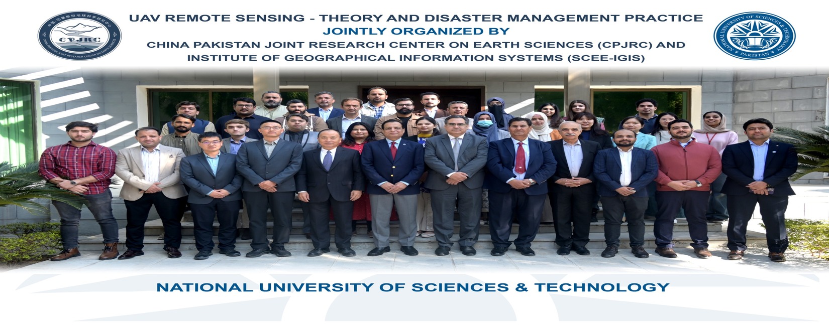
The International Workshop on UAV Remote Sensing for Disaster Management successfully concluded at IGIS–SCEE, NUST, bringing together experts from Pakistan and China to strengthen national capacity in advanced UAV-based disaster monitoring, rapid assessment, and geospatial analytics. The four-day hands-on training was jointly conducted by the China–Pakistan Joint Research Center (CPJRC) and IGIS–SCEE, reflecting continued cooperation between the two countries in science, technology, and disaster risk reduction.
The workshop featured international trainers from the Chinese Academy of Sciences (CAS), senior NUST faculty members, and practitioners from multiple public-sector and private organizations. Following was the list of instructors:
- SHI Pilong
- LI Dong
- Javed Iqbal
- Shahid Nawaz Khan
Day-Wise Highlights
Day 1 – Inauguration & Foundational Concepts
The event commenced with a formal opening ceremony, followed by welcome remarks from:
- Prof. Dr. Muhammad Irfan, Principal & Dean SCEE
- Prof. Dr. Mumtaz Shah, QAU
- Prof. Dr. Hong Tianhua, Executive Director, CPJRC
A group photo marked the official opening.
Participants were introduced to:
- Fundamentals of UAV systems
- Remote sensing principles & photogrammetry
- UAV regulations, flight planning, and sensor selection
- Software demonstrations and basic operations
The day concluded with an interactive discussion session.
Day 2 – UAV Data Acquisition & Processing
Following topics were covered in Day-2:
- Position & attitude processing
- Rectification and 3D modeling
- Oblique photography and mission-planning techniques
Participants also engaged in hands-on flight operations and real-time UAV software training.
Day 3 – Practical Applications & Case Studies
The third day was dedicated to advanced data processing, including:
- UAV orthophotos, oblique imagery, and 3D reconstruction
- Change detection and rapid disaster loss assessment
- Landslide displacement analysis and 3D modeling
Prominent Pakistan-based case studies were discussed, including:
- Badswat Glacier Debris Flow Hazard Assessment
- Glacier Avalanche Simulation in Gayari Sector
- Landslides modeling and mapping along the KKH
This provided participants with contextualized insights into local geohazard environments.
Day 4 – Way Forward, Recommendations, & Closing Ceremony
The final day featured:
- Synthesis session and participant discussions
- Workshop summary and future research directions
- Participants online feedback about the workshop
- Certificate distribution ceremony presided over by Prof. Dr. Muhammad Irfan, Principal & Dean SCEE
- A guided tour of key NUST innovation facilities, including NSTP and SINES
The workshop concluded with a farewell tea and networking session.
Key Outcomes
- Enhanced national capacity in UAV-based disaster monitoring and geospatial analysis
- Hands-on training enabling participants to plan, acquire, and process UAV remote sensing data
- Strengthened collaboration between NUST–IGIS and Chinese Academy of Sciences (CAS)
- Exposure to real-world geohazard case studies relevant to Pakistan
- Development of professional networks among academia, researchers, and practitioners
Participation
The workshop received enthusiastic participation from:
- Government agencies
- Academia & research institutions
- Disaster management organizations
- Private-sector engineering and geospatial firms
Participants represented diverse backgrounds in civil engineering, geoinformatics, environmental sciences, and disaster risk management.